Being able to read the clouds is one of the simplest and most useful outdoor skills. It costs nothing, works anywhere, and can keep you ahead of shifting weather at home, at camp, and on the trail. This guide walks through the main cloud families you will see, what each one usually means, and how to combine clues for a solid field forecast. We will also cover why the same sky can behave differently at sea level and on a mountaintop.
How Clouds Are Organized
Meteorologists group clouds by altitude and by appearance. Altitude gives you context about the air mass and what kind of weather energy is in play. Appearance tells you about motion, moisture, and stability.
- High clouds above ~20,000 ft or 6,000 m: mostly ice crystals, thin, white, often fibrous.
- Middle clouds 6,500 to 20,000 ft or 2,000 to 6,000 m: mostly water drops, sometimes ice, layered or patchy.
- Low clouds surface to ~6,500 ft or 2,000 m: liquid water, layered decks or ragged sheets, often bring drizzle or steady rain.
- Vertical development: clouds that grow from low levels through the middle and sometimes into the high layer. These are the classic fair weather puffs and the big thunderheads.
High Clouds: First Signals From Afar
Cirrus

Thin, wispy streaks high in the sky. They form from ice crystals swept by strong upper winds. Cirrus often arrive a day or so before a warm front or a large-scale storm system. If the streaks thicken and cover more of the sky as the day goes on, weather is changing. If they remain light and scattered under a steady barometer, fair weather usually holds.
Cirrostratus
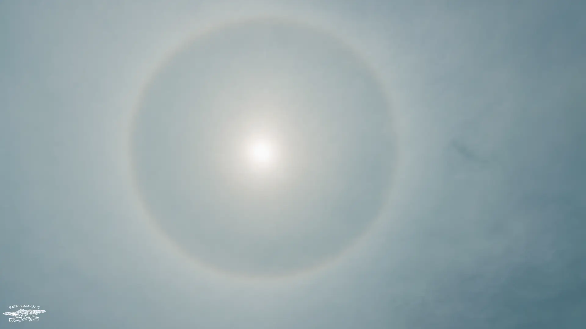
A milky veil that can cover the entire sky. The sun or moon shines through with a clear halo. That ring is your early alert that moisture and lift are spreading aloft. Cirrostratus often appears 12 to 24 hours before widespread precipitation. Plan for deteriorating conditions tomorrow, not necessarily today.
Cirrocumulus

Small, grainy ripples that can look like fish scales. Old mariners called this a mackerel sky. It points to instability above and can precede a front or jet streak. If winds at the surface freshen during the day and pressure falls, treat it as a change signal.
Middle Clouds: The Transition Layer
Altostratus
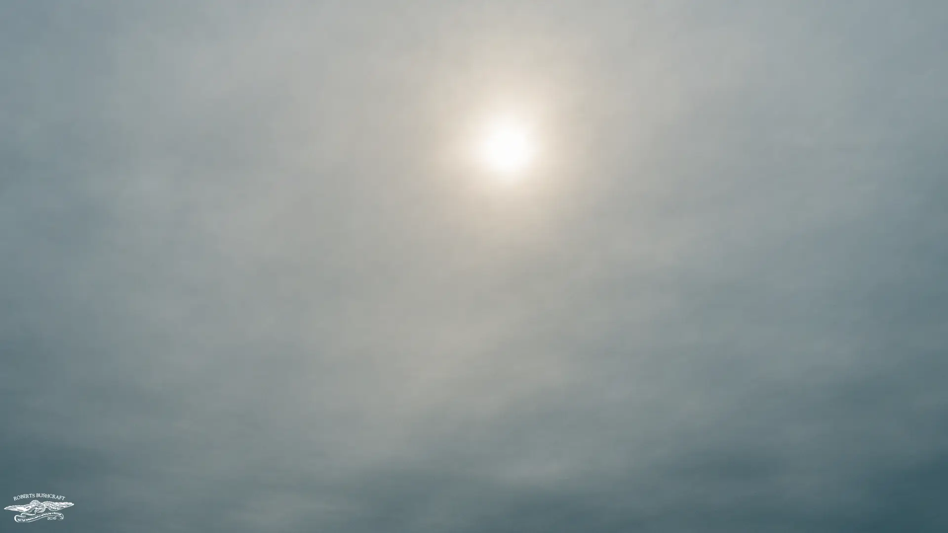
A gray or blue-gray sheet that dims the sun to a bright spot. This is the classic approach shield of a large storm. It often thickens downward into nimbostratus with steady rain or snow. If you wake to altostratus and the deck lowers, expect continuous precipitation to follow.
Altocumulus

Rounded patches or bands at mid levels. When seen on a warm, humid summer morning, altocumulus can be a hint of afternoon thunderstorms. When seen with a quickening breeze and falling pressure, they can mark a front on approach. The pattern matters. Parallel streets or waves point to stronger winds aloft and a dynamic day.
Low Clouds: What You Feel Right Now
Stratus
Low, uniform gray. Think fog that does not reach the ground. Stratus brings cool, damp conditions with mist or light drizzle. Wind sheltered valleys and coasts get a lot of stratus after nighttime cooling. Expect slow improvement only if you see breaks with rising temperature or a shift to drier wind.
Stratocumulus
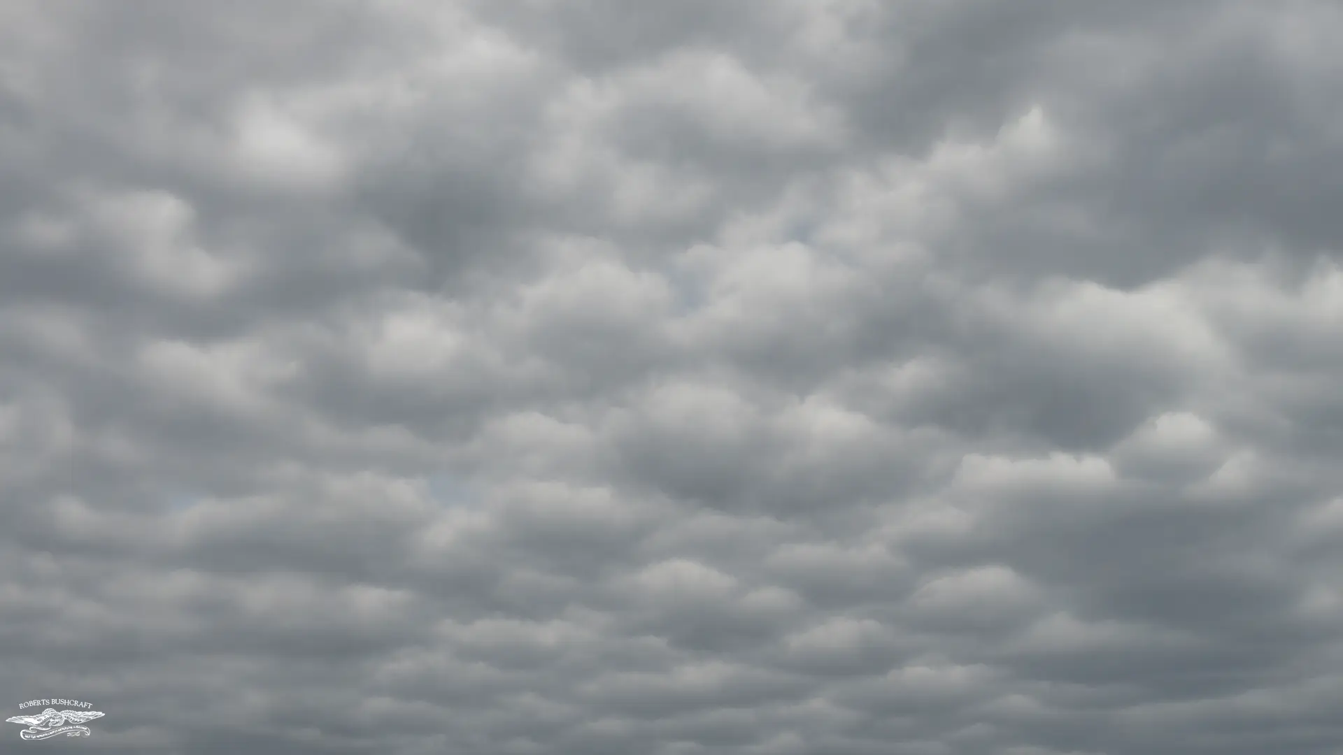
Low, lumpy sheets with thin, bright gaps. Often follows a cold front when the lower atmosphere is still churning. You may get brief sprinkles, then sunny breaks. If the lumps flatten and the gaps widen, the day is stabilizing.
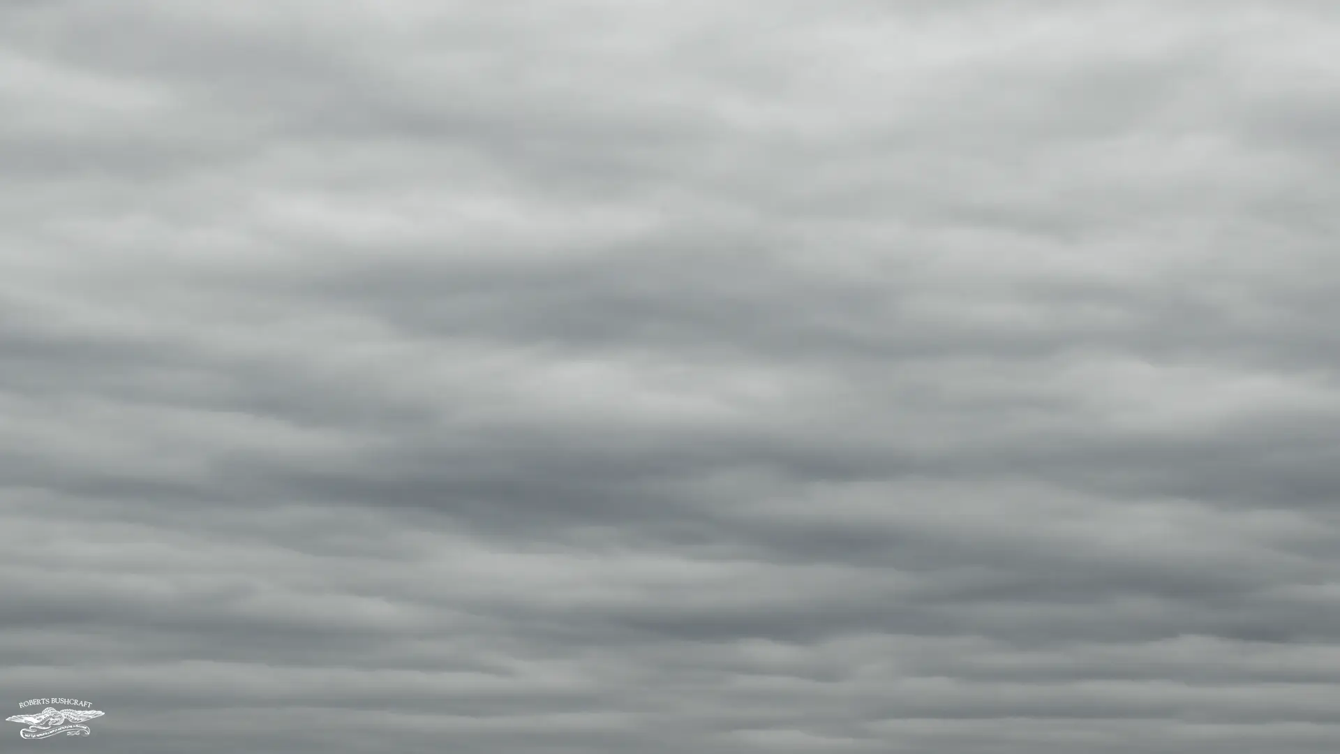
Nimbostratus
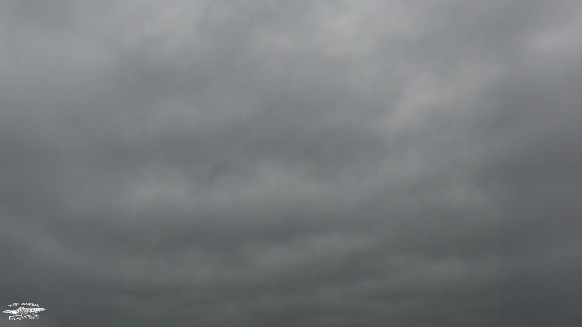
Thick, dark gray layers that spread across the sky and deliver steady rain or snow for hours. No sharp edges, no sun, no lightning. This is your all-day soaker. Campsite drainage and dry storage matter more than wind protection with nimbostratus.
Vertical Development: From Friendly Puffs to Dangerous Storms
Cumulus

White, cotton-topped clouds with flat bases. These are signs of surface heating and rising bubbles of air. If they stay small with sharp edges under a light breeze, you likely have fair weather. Watch for growth pace. If the tops boil upward and edges soften, instability is increasing.
Cumulonimbus
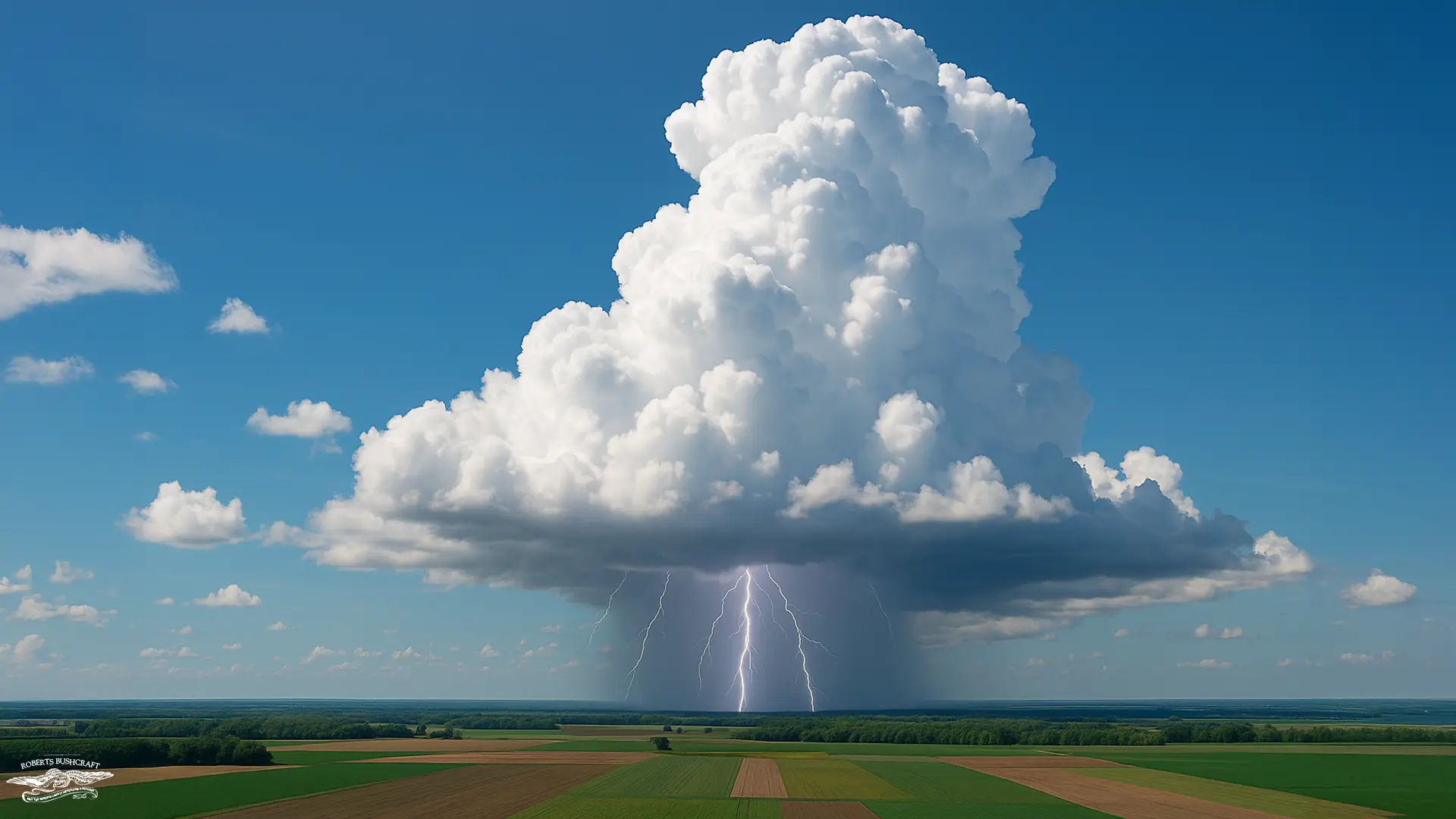
Towering thunderheads with dark bases and an anvil top that spreads downwind. Lightning, downpours, hail, strong gust fronts, and rapid temperature drops are all on the table. The safest choice is to be off exposed ridges, out of open fields, and away from tall isolated trees before the first thunder is heard.
Fast Field Checks You Can Use
- Cloud base height estimate with Fahrenheit readings: cloud base in feet above ground is roughly 1000×(T−Td)÷4.4, where T is air temperature and Td is dew point. A small spread means a low cloud base and quicker onset of fog or drizzle.
- Thickening trend: high clouds that thicken and lower through the day mean a front or wave is approaching. Set camp early and secure gear.
- Mid-level waves by late morning on a humid summer day often lead to afternoon storms. Plan ridge time for the morning and route to lower ground after lunch.
- Anvil direction shows upper-level winds. The storm base moves more slowly than the anvil. Do not assume safety because the anvil passes first.
- Halos around the sun or the moon are a 12 to 24-hour clock for rising moisture. Consider tomorrow’s plans, resupply, and travel windows.
Sea Level vs Mountaintop: Same Sky, Different Outcome
Why mountains change the rules
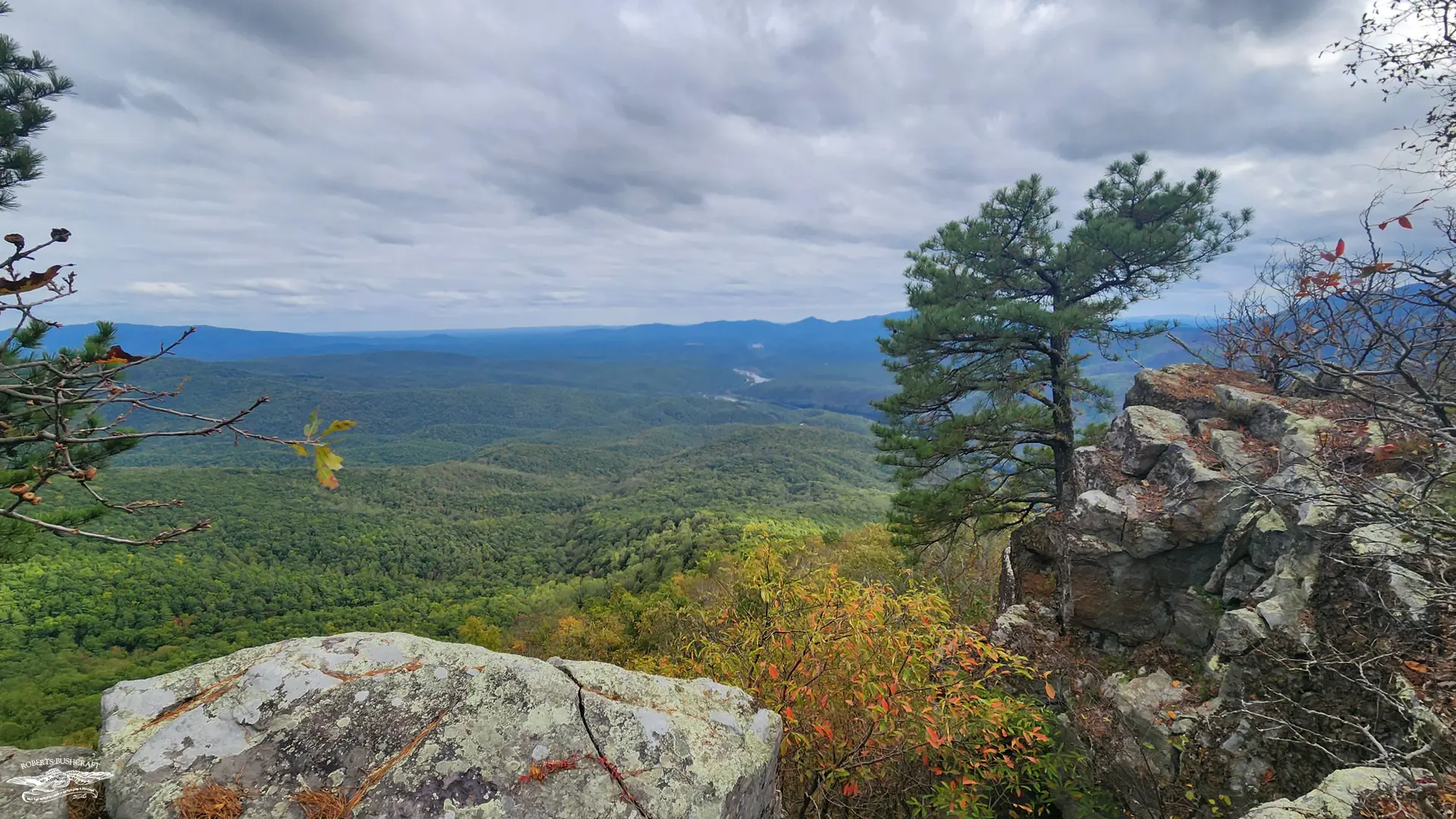
Mountains create their own weather, and one of the biggest drivers is orographic lift. As wind climbs a ridge, it cools and condenses, causing clouds to thicken and precipitation to increase on the windward side. It is common to hike into a cloud deck that would never form in the valley below, which can make the environment feel completely different within a short climb.
Weather also shifts much faster at elevation. The free atmosphere sits closer to you on a mountaintop, and even a small pressure change can flip conditions from clear to foggy in minutes. A day that starts bright and dry can suddenly turn damp and gray, especially above tree line.
Temperatures drop as you gain height, following an environmental lapse rate of roughly 3.5°F per 1,000 feet. Add steady wind on exposed ridges and the chill deepens quickly. When you are already in cloud or rain, the wet-bulb temperature drops enough to make hypothermia a real threat, even in seasons that feel mild at the trailhead.
Lightning risk is also higher in the mountains. A distant cumulonimbus cloud may be ten or even twenty miles away, but first strikes often reach exposed summits without warning. If cumulus towers start showing sharp vertical growth before noon, it is a strong signal to plan your route so you are off high ground early.
Cloud bases matter too. A cloud base at two thousand feet might mean nothing more than a low overcast sky at sea level, but it becomes dense, cold fog when the terrain rises into it. On a three-thousand-foot ridge, that same cloud deck sits right where you are walking. Visibility drops, navigation becomes more difficult, and the added moisture and wind increase the risk of hypothermia much faster than most hikers expect.
- Orographic lift: wind that climbs a ridge cools and condenses. Clouds thicken and precipitation increases on windward slopes. You may hike into a cloud deck that never forms in the valley.
- Faster weather swings: the free atmosphere is closer. A small pressure change can flip conditions from clear to foggy in minutes at elevation.
- Lower temperature and higher wind: the environmental lapse rate is roughly 3.5°F per 1,000 ft or 6.5°C per 1,000 m. Add wind on exposed ridges and the wet-bulb temperature risk rises quickly in rain or cloud.
- Lightning risk: cumulonimbus may be 10 to 20 miles away, yet the first strikes can reach exposed summits. If cumulus towers show crisp vertical growth before noon, build a plan to be off high ground early.
- Cloud base relative to terrain: a 2,000 ft cloud base can mean low overcast at the coast but walking in fog on a 3,000 ft ridge. Navigation difficulty and hypothermia risk rise fast with stratus on the trail.
Practical adjustments
At sea level, high cloud shields and halos are often your first signs that weather is changing. These subtle features give you valuable early warning before conditions deteriorate. When nimbostratus settles in, drainage and flooding become the primary concerns, especially in low-lying or poorly drained areas. Thunderstorms pose less of a visibility threat near the coast, but strong wind exposure is the main hazard to watch.
In the mountains, the risks shift. Visibility and lightning quickly become the dominant concerns, since fog and low stratus can wrap a ridge in minutes. A reliable map and compass plan is essential, not just a convenience. It helps you stay oriented when the trail disappears into cloud. Ridge travel is best handled in the morning when conditions are more stable, and having clear bail routes to treeline gives you a safe escape if storms begin to build. Pack your insulation in dry bags as well, because once you are cold and wet at elevation, recovering warmth becomes far more difficult.
- At sea level: halos and high cloud shields are your early warnings. Drainage and flood awareness matter with nimbostratus. Wind exposure is the main thunderstorm hazard.
- On mountains: visibility and lightning are the prime risks. Carry a solid map and compass plan for stratus and fog. Time ridge travel for mornings, identify bail routes to treeline, and secure insulation in dry bags.
Putting It Together: Simple Forecast Playbook
- Morning cirrus that thickens to cirrostratus with a halo: change incoming in 12 to 24 hours. Stage camp chores and consider a shorter travel day tomorrow.
- Altocumulus by late morning on a warm humid day: convection likely. Expect scattered thunderstorms from mid-afternoon into evening. Plan to be below treeline by early afternoon.
- Altostratus lowering to featureless gray: widespread steady precipitation on the way. Choose higher, well drained ground and protect sleeping gear now.
- Stratocumulus after a front: cool breezy day with sunny breaks. Good travel window once showers cease.
- Cumulus towers with anvils and distant thunder: move to lower ground, avoid ridges, open water, and isolated tall trees. Wait 30 minutes after the last thunder before resuming exposed travel.
Gear and Safety Checklist
- Waterproof layer accessible, not buried.
- Warm layer that insulates when damp. Wool or high-loft synthetics are dependable.
- Map, compass, and a known alternate route for fog or lightning delays.
- Headlamp ready before nimbostratus steals your daylight.
- Storm protocol discussed with your group. Where to shelter, how to avoid conductors, and a rally point if visibility drops.
- Midland ER10VP Emergency Alert Weather Radio
- Midland ER310 Emergency Crank Weather Alert Radio
Cloud watching is more than nature art
Cloud watching is more than nature art. It is a living forecast that updates every few minutes. Learn the shapes, watch how they change through the day, and keep notes. The skill pays off on a backyard grill night, on a lake paddle, and on a long ridge walk. A little practice turns the sky into a trustworthy partner.